How Long Is the Cowles Mountain Hike? Full Trail Guide 2026
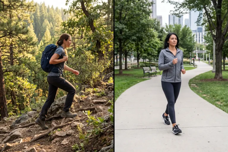
The standard Cowles Mountain hike covers 3 miles round-trip, gains about 950 feet in elevation, and takes most hikers 1.5 to 2 hours to complete. This guide breaks down the exact distance from each trailhead, the climb time by fitness level, alternate routes up the mountain, and what the hike feels like once you start moving up the slope.
To answer how long the Cowles Mountain hike is: the main southwest route from Golfcrest Drive and Navajo Road runs 3 miles round-trip with 950 feet of elevation gain. Most hikers reach the 1,593-foot summit in 45 to 75 minutes, then take 30 to 45 minutes to come back down.
How Long Is the Cowles Mountain Hike?
The most popular Cowles Mountain hike is 1.5 miles one-way and climbs roughly 950 feet to the summit. That puts the round-trip at 3 miles. The trail starts in the San Carlos neighborhood of San Diego and finishes at the 1,593-foot summit, the highest point of the city of San Diego. AllTrails GPS data records the climb at 912 feet over 2.9 miles, with most hikers finishing in 1.5 to 2 hours.
Distance changes based on which trailhead you pick. The southwest approach is the shortest. The Big Rock Trail from Santee is the longest standard route. The Barker Way trail on the east side falls between the two.
Trail Distance by Route
Cowles Mountain has three commonly used routes. Each one ends at the same summit, but the length and effort change.
- Golfcrest and Navajo trailhead (main route): 3 miles round-trip, around 950 feet elevation gain, rated moderate
- Big Rock Trail from Santee: 4.9 miles round-trip with 1,210 feet of elevation gain, taking 2.5 to 3 hours, rated hard
- Barker Way (east side): about 2.9 miles round-trip with a similar climb to the main route, far fewer crowds
The main route is the fastest way up. Big Rock adds distance and difficulty because it starts lower in Santee and links into the Cowles Service Road before the summit. Barker Way feels quieter on weekday afternoons.
Where the Trail Starts
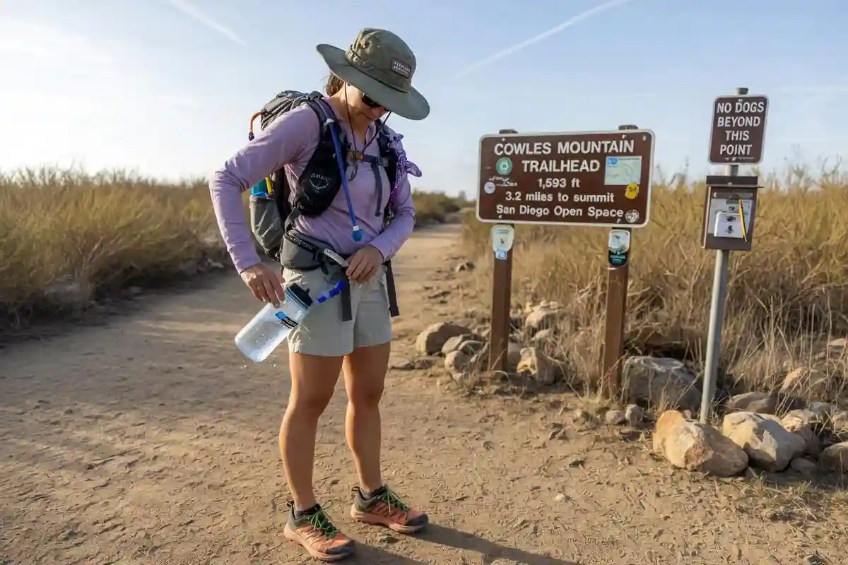
The primary trailhead sits at the corner of Golfcrest Drive and Navajo Road in San Carlos, San Diego. A small parking lot and street parking are available, though both fill early on weekends. Cowles Mountain is part of Mission Trails Regional Park, the largest municipally owned park in Southern California at nearly 7,000 acres.
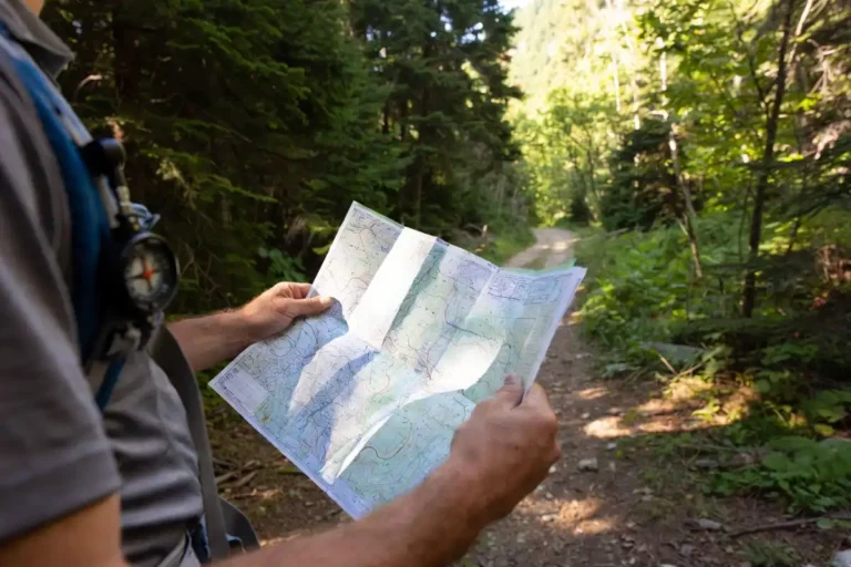
For first-time visitors, planning the day ahead saves time and stress. I covered the basics in my notes on how to plan a day hike without losing the trail, and the same approach applies to popular front-country trails like this one.
How Long Does It Take to Hike Cowles Mountain?
Most hikers finish the round-trip in 1.5 to 2 hours, including a short summit break. Time on the mountain depends on fitness level, walking pace, and how busy the trail is on the day. A steady moderate pace gets you to the top in 45 to 60 minutes. A slower pace with photo stops adds 15 to 30 minutes.
Average completion times by fitness level:
- Trained hikers: 35 to 45 minutes up, 25 to 30 minutes down
- Average fitness: 50 to 70 minutes up, 35 to 45 minutes down
- Beginners or families with kids: 75 to 90 minutes up, 45 to 60 minutes down
The descent is faster but harder on the knees because of the steep, eroded sections near the top.
Elevation Gain and Difficulty
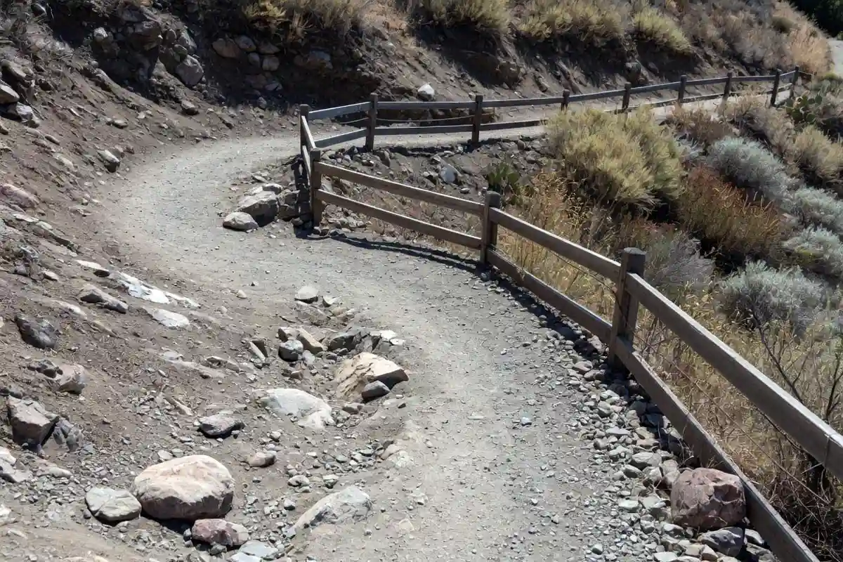
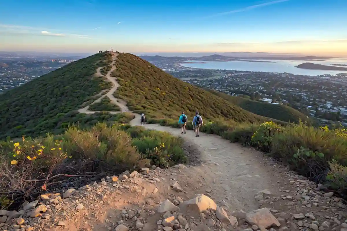
The Cowles Mountain trail climbs from a starting elevation of 659 feet to a peak elevation of 1,593 feet, which puts the gain at roughly 935 to 950 feet. The trail is rated moderate. The first half climbs at a gradual grade. The upper half winds through a series of roughly 37 switchbacks that continue for nearly the length of the trail and gets steep and rocky near the top.
There is almost no shade. The trail runs through coastal sage scrub and chaparral, which means full sun exposure for most of the climb. On a hot day, this matters more than the distance.
I wrote a full guide on how to hike safely when the weather turns hot, and the same rules apply on Cowles in summer.
How to Hike Cowles Mountain (Step by Step)
Here is the basic flow from the main southwest trailhead.
- Park early. Spots near Golfcrest fill up by 7 a.m. on weekends. Park along the curb on the street, never above it.
- Start at the wood signpost. The trail begins as a wide dirt path with low fencing on both sides.
- Climb the lower switchbacks. The first 0.5 mile gains elevation at a steady grade. Pace yourself early.
- Pass the Barker Way junction. At about 1.0 mile, the eastern route meets the main trail. Stay left for the summit.
- Tackle the upper section. The last 0.5 mile is the steepest. Loose rock and erosion call for careful footing.
- Reach the summit. A stone marker confirms the top at 1,593 feet. The 360-degree view covers downtown San Diego, the Pacific Ocean, and the Cuyamaca range to the east.
- Return on the same trail. Take it slow on the rocky descent.
If you want to manage your energy on the steeper parts, my notes on how to pace a long climb without burning out cover the basics.
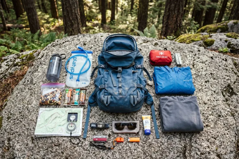
What to Bring for the Hike
Cowles is a short hike, but it is exposed and steep. The right gear keeps the trip safe and the legs fresh.
- Water: at least 1 liter per person, more in summer
- Sun protection: hat, sunglasses, and sunscreen
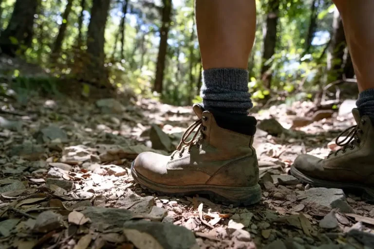
- Footwear: trail runners or low hikers grip loose rock better than street shoes
- Snacks: a small high-energy snack for the summit
- Phone: for offline maps and emergency contact
| Preview |
#1

|
#2

|
#3

|
#4

|
|---|---|---|---|---|
| Title | Merrell Men's Accentor 3 Hiking Shoe | Badger Reef Safe Mineral Sunscreen | Retro Aviator Steampunk Polarized Sunglasses | Nature's Garden Healthy Trail Mix Snack Pack |
| Price |
$110.00
See Latest Price
|
$18.99
See Latest Price
|
$3,152.91
See Latest Price
|
$21.00
See Latest Price
|
| Star Rating |
4.5
(1,009)
|
4.5
(2,369)
|
4.3
(663)
|
4.7
(10,865)
|
For footwear questions, my beginners guide on hiking boots vs hiking shoes breaks down what works on rocky front-country trails like this one.
Best Time to Hike Cowles Mountain
Early morning is the best time to hike. Sunrise starts in cool air and finishes before the sun heats the rocks. Late afternoon also works in fall and winter, when sunset views from the top stay clear. Avoid midday in summer. The trail surface gets hot, the lack of shade adds heat stress, and afternoon temperatures often climb above what the average hiker plans for. Weekdays are quieter than weekends by a wide margin.
Mistakes to Avoid
Three common mistakes turn an easy hike into a slow one.
The first is starting too late in summer. The trail faces south and west, so afternoon temperatures on the rocks climb fast. The second is wearing flat-soled sneakers. The upper switchbacks have loose gravel and small rocks that shift underfoot. The third is bringing too little water. Many hikers treat this as a short city hike and underpack on hot days.
Safety Tips
Cowles is a city-edge trail, but the climb still demands care. Watch your footing on the descent. The eroded sections near the top cause more falls than the climb itself. Keep dogs on a leash, which is required by park rules, and check the rock surface temperature before letting them walk on it.
If you have a history of knee pain, the descent is when joints take the most strain. My notes on how to protect knees on downhill sections cover technique that works on rocky trails.
If the forecast reads above 90°F, move the hike to dawn or pick another day. The National Weather Service heat safety page lists exposed trails as a common heat illness risk, and Cowles fits that profile in summer.
FAQs about Cowles Mountain Hike
Is the Cowles Mountain hike hard?
How long does it take to hike Cowles Mountain?
Can beginners hike Cowles Mountain?
Are dogs allowed on the Cowles Mountain trail?
What is the elevation at the Cowles Mountain summit?
Final Thoughts
The Cowles Mountain hike is short on paper but big on payoff. Three miles round-trip, around 950 feet of climb, and a panoramic summit that reaches from the Pacific Ocean to the eastern mountains. Plan for an early start, bring enough water, and pick the route that fits your fitness. The main southwest trail is the fastest way up. Big Rock and Barker Way trade more distance for fewer crowds.