Do I Need a GPS for Hiking? What to Carry on Every Trail

Every hiker asks this before spending money on gear. The answer changes with where you hike, how long you stay out, and what happens when your phone dies. Below I break down the decision, compare the device options, and share what I carry in the Bandarban hills.
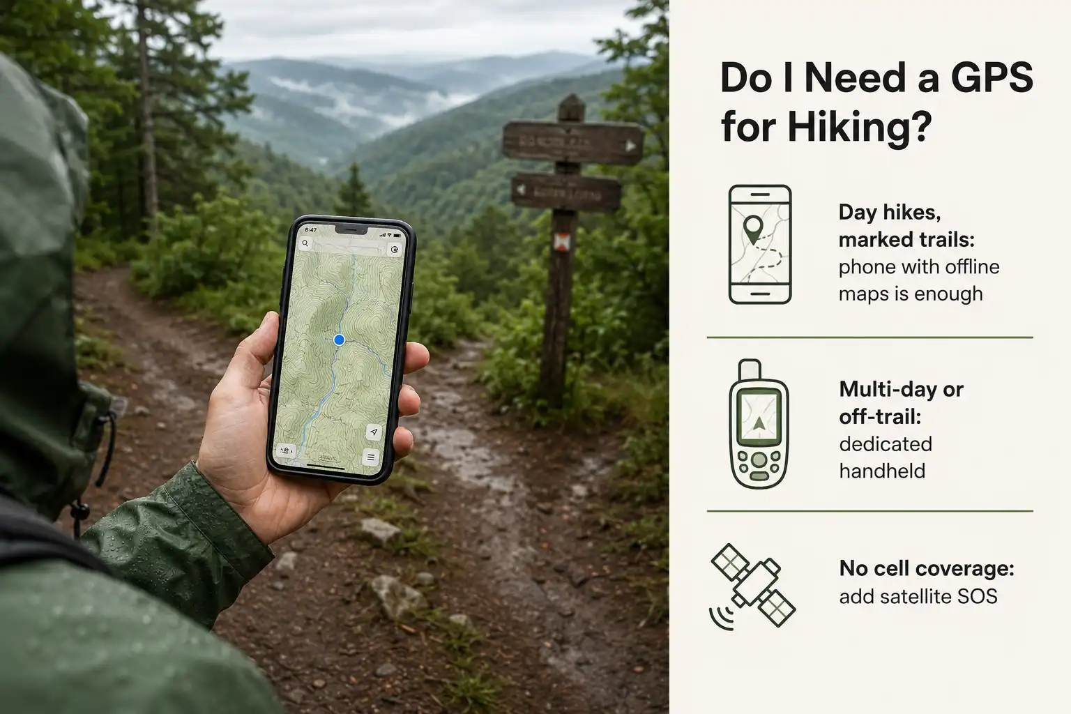
You need GPS navigation on nearly every hike, but you rarely need a separate GPS device. Your phone already has a GPS receiver, and offline maps handle marked trails well. However, remote, multi-day, or off-trail routes push the answer toward a dedicated handheld unit.
Do you need a GPS for hiking?
You need GPS on most hikes, though your phone usually covers it. Marked day trails, popular parks, and weekend trips rarely justify a second device. Longer or wilder trips change that math quickly, because a phone becomes a single point of failure once you are hours from a road.
Ask yourself four questions before buying anything:
- How far from help will you be? Under an hour from a trailhead, a phone is fine. Half a day out, add redundancy.
- How long is the trip? Anything past two days strains phone battery, even with a power bank.
- How marked is the route? Junction-heavy or unmarked terrain demands better tools than a signposted loop.
- What is the weather doing? Cold and rain kill phones fast. Rugged units shrug both off.
Answer “close, short, marked, mild” to all four and your phone wins. Answer the opposite on two or more, and a handheld unit starts paying for itself.
This matters more than people expect. Research on wilderness search and rescue found that wandering off trail ranks as the number one reason adult hikers need rescue, ahead of injury and bad weather. Navigation failures, not falls, drive most searches.
Can your phone replace a hiking GPS?
Yes, for most day hikes your phone genuinely replaces a GPS unit. Modern phones carry real satellite receivers, not simplified versions. Still, they carry weaknesses that matter once conditions turn.
Your phone works without cell service
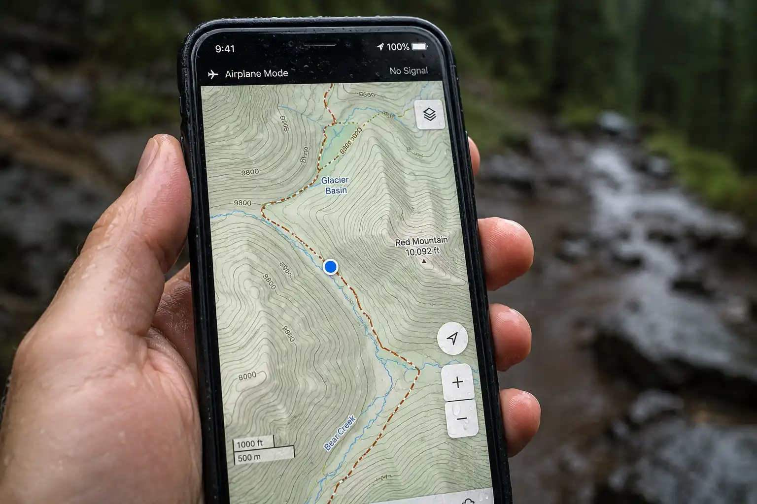
This surprises many hikers, so let me be clear about it. Your phone’s GPS chip receives signals directly from satellites. It sends nothing back, and it never touches a cell tower to find your position. Therefore your blue dot keeps working in zero-bar terrain, provided you downloaded the map beforehand.
The catch sits in that last clause. Online map apps stream tiles over data. Once signal drops, the map turns blank while the dot still moves across an empty screen. Download offline maps at home instead, over Wi-Fi, and cover a wider area than your planned route.
Where phones fall short
Phones fail in four predictable ways. First, batteries drain fast when the screen wakes constantly and the radio hunts for absent towers. Second, cold weather cuts runtime hard, sometimes by half. Third, glass and thin cases lose arguments with rock. Finally, a wet touchscreen becomes almost unusable in rain, exactly when you most need to check your route.
Airplane mode fixes much of the battery problem. GPS keeps working, since the receiver only listens. Meanwhile the cellular radio stops burning power searching for a signal that is not there.
How accurate is GPS on the trail?
Expect roughly 5 meters of accuracy under open sky, and considerably worse under trees. According to GPS.gov, GPS-enabled smartphones typically land within a 4.9 meter radius under open sky, though accuracy degrades near buildings, bridges, and trees.
That degradation is the part hikers underestimate. I have watched my position jump across a ridge while walking under heavy canopy on the Bandarban trails, and dense hill forest does this constantly. Steep valleys make it worse, because canyon walls block half the sky and bounce signals off rock.
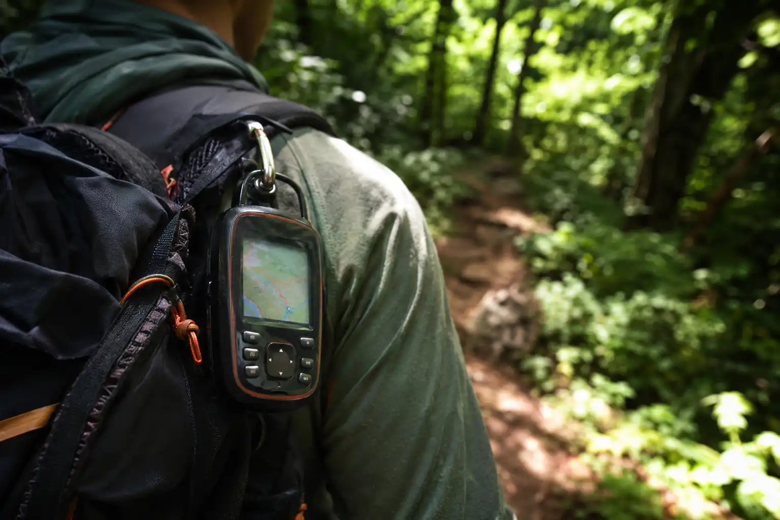
Newer phones and handheld units handle this better through multi-band reception. Instead of listening on one frequency, they use two, which filters out reflected signals. Garmin’s GPSMAP 67 series, for example, accesses multiple satellite systems and multiple frequencies for improved accuracy where signals are reflected or weak. One long-term reviewer measured roughly 8 feet of accuracy under 90 percent canopy using multi-band reception.
So treat the blue dot as an estimate, not a fixed point. When the screen and the terrain disagree, trust the terrain and stop to reorient. That habit sits at the center of staying oriented in country you have never walked before.
When does a dedicated handheld GPS make sense?
A handheld unit earns its weight on long, remote, or rough trips. Battery life drives the decision more than accuracy does. The GPSMAP 67, for instance, runs up to 180 hours in GPS mode and up to 840 hours in expedition mode. No phone approaches that, even with a heavy power bank.
Buy a handheld unit if you match two or more of these:
- You hike multi-day routes without charging points
- You travel off-trail, or on unmarked and poorly signed paths
- You hike in winter, heavy rain, or persistent fog
- You need one device that survives drops and immersion
- Your phone doubles as your camera and drains by mid-afternoon
Skip it if you stick to popular day trails and carry a small power bank. Spending around 400 to 600 US dollars on a rugged navigator makes little sense for a two-hour loop with signposts at every junction. Prices shift, so check current listings before you buy.
Watches sit between the two. A GPS watch tracks your route and points you back along it, yet the tiny screen shows almost no useful map detail. Treat a watch as a supplement, never as your primary map.
Do you also need a satellite messenger or PLB?
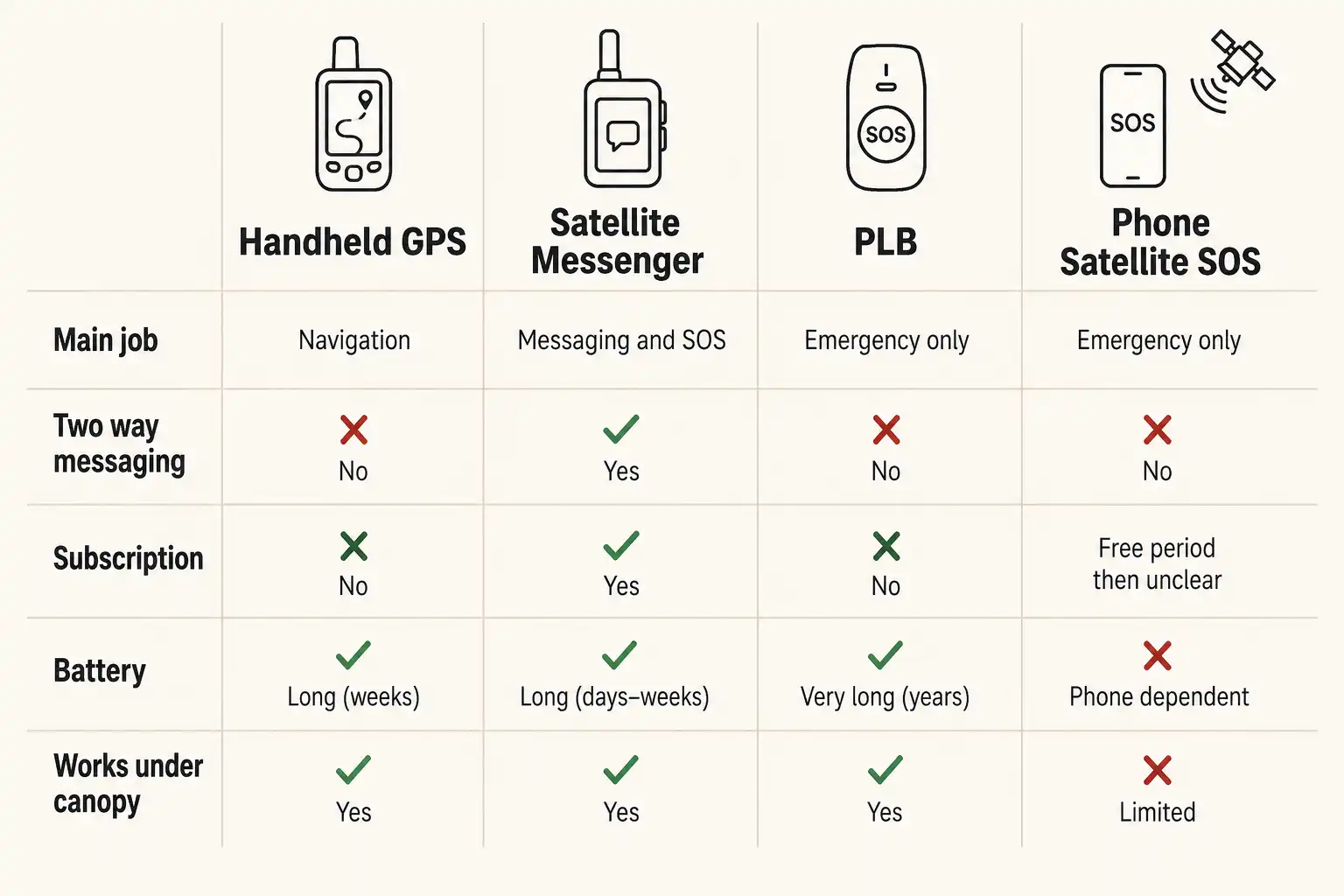
These devices answer a different question than navigation does. A GPS tells you where you are. A satellite communicator tells someone else where you are, which matters enormously once you cannot walk out. Many hikers conflate the two and buy the wrong tool.
Satellite messengers
Satellite messengers send two-way texts and an interactive SOS through commercial satellite networks. Garmin’s inReach Mini 2 runs up to 14 days in 10-minute tracking mode and up to 30 days at a 30-minute interval. Additionally, it can guide you back along your recorded track if you take a wrong turn.
The trade-off is cost. These units need an active subscription, and plans generally run somewhere between 15 and 65 US dollars monthly depending on message volume. Frequent backcountry hikers absorb that easily. Occasional hikers often do not.
PLBs
A PLB is a one-way emergency transmitter, and it does exactly one job. Press the button and it broadcasts a distress signal on 406 MHz to the international Cospas-Sarsat satellite system, which relays your coordinates to rescue authorities. In the United States, registration with NOAA is free and required before use.
Two practical advantages stand out. There is no subscription, and the transmitter is stronger. As Colorado Search and Rescue notes, these units use a 5-watt transmitter compared with roughly 1.6 watts on a satellite messenger, which helps push a signal through dense overhead foliage. On the other hand, you cannot describe your emergency or hear back.
Satellite SOS built into phones
Newer phones now include emergency satellite messaging, which narrows the gap. Apple states that Emergency SOS via satellite is free for two years after activation of an iPhone 14 or later, and the company has repeatedly extended that window. On Android, Satellite SOS covers Pixel devices from the Pixel 9 onward, excluding the Pixel 9a.
Both systems need a clear view of the sky and correct aiming. Consequently they struggle under canopy, exactly where a stronger dedicated transmitter still wins. Treat phone satellite SOS as a genuine safety net, not as a full replacement for a dedicated unit on remote trips.
What should you carry on each type of hike?
Match your tools to the trip rather than buying the most expensive option available. Here is how I set it up:
Short marked day hike, near a road: Phone with offline maps, plus a small paper map or printed screenshot. Nothing else required.
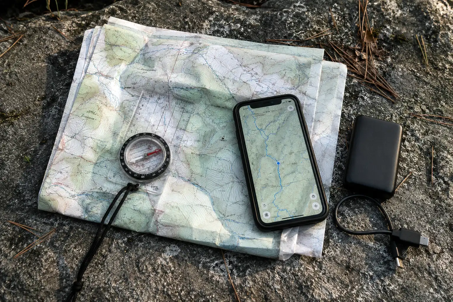
Full-day hike in a park or hill area: Phone with offline maps, power bank, paper map, and a baseplate compass. Tell someone your route and return time.
Multi-day trek or remote terrain: Phone with offline maps, handheld GPS or satellite messenger, paper topo map, compass, and a power bank. Carry the emergency device where you can reach it, not buried in your pack.
Off-trail, winter, or solo remote travel: Everything above, plus a PLB or messenger you have actually tested. Learn the SOS procedure before you leave, because reading instructions during an emergency wastes time you may not have.
The wider kit matters too. Navigation forms only part of the ten items every hiker should carry, and the rest of that list keeps you alive if navigation fails.
Why do maps and compasses still matter?
A map and compass work when nothing else does, and that alone justifies the few ounces. The National Park Service lists navigation as the first of the ten essentials and advises hikers to know how to use a topographic map, compass, or GPS unit before going out, and to bring a physical map as backup.
Batteries die. Screens crack. Devices freeze at the worst moment. A compass needle keeps pointing north regardless, and paper stays readable when wet if you bag it properly.
There is a second reason, and it is less obvious. A paper map shows the whole landscape at once. A phone screen shows a small window, so you lose the surrounding context that helps you recognize a wrong turn early. Learning how to hold your line in a forest without a screen builds judgment no app can substitute for.
Practice at home first. Orient the map, take a bearing, and walk it in a park. Skills learned on an easy afternoon transfer to hard days later.
How do you set up your phone as a hiking GPS?
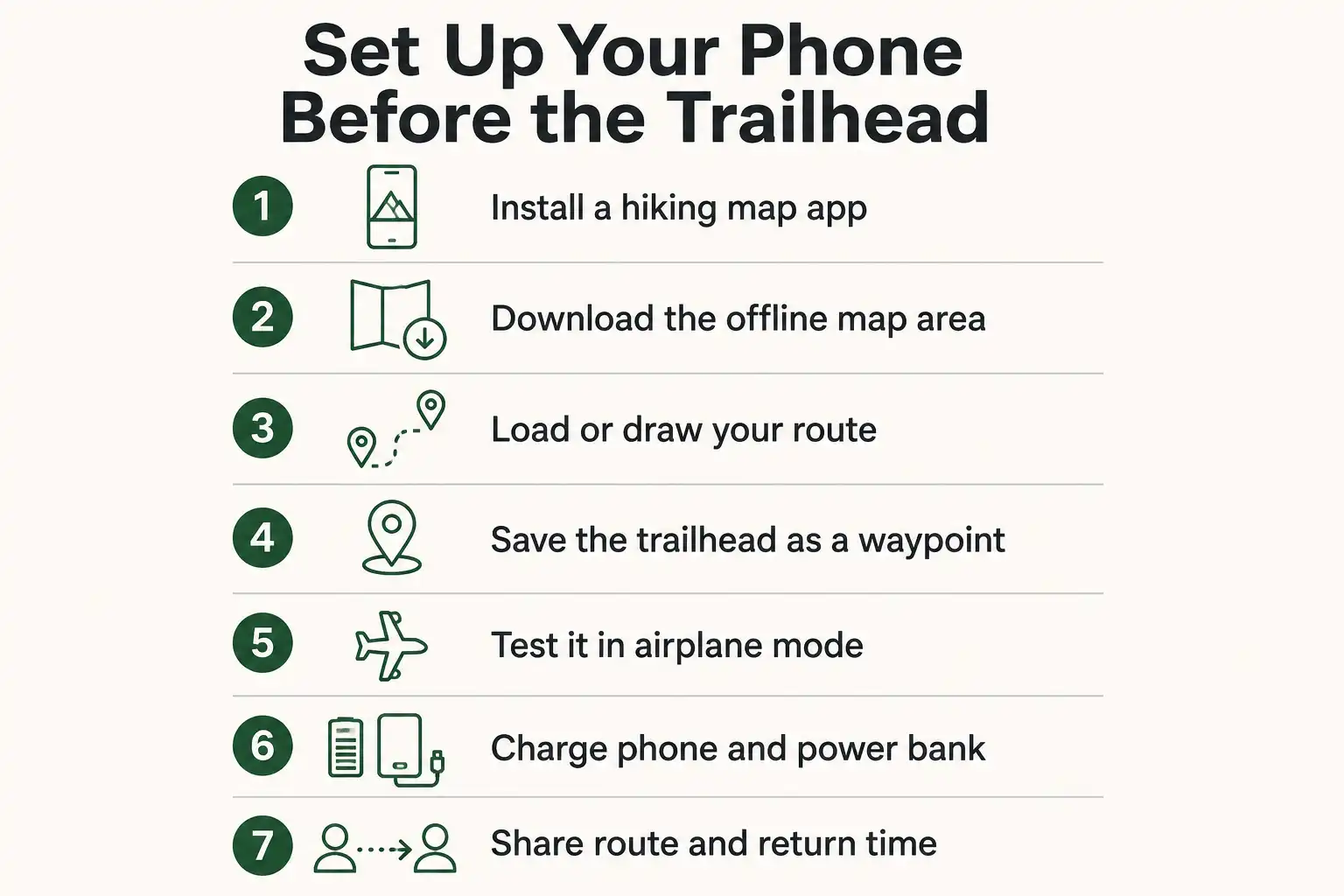
Set it up at home, before you leave, because trailhead parking lots often have no signal either. Work through these steps in order:
- Install a proper hiking app. Gaia GPS, AllTrails, CalTopo, and Organic Maps all support offline topographic maps. Free versions cover basic needs.
- Download your map area. Cover a buffer well beyond your planned route, since wrong turns happen outside the box you drew.
- Load or draw your route. Import a GPX track when one exists, or trace the route yourself.
- Save the trailhead as a waypoint. Your car becomes a fixed reference you can navigate back to.
- Test offline. Switch on airplane mode at home and confirm the map still renders and the dot still moves.
- Charge everything. Phone, power bank, and headlamp. Cold nights drain all three.
- Share your plan. Send your route and return time to someone who will notice if you go quiet.
That last step costs nothing and shortens searches dramatically. It pairs naturally with planning a day hike so you stay found in the first place.
What mistakes do hikers make with GPS?
Four mistakes cause most trouble, and all four are avoidable. First, hikers download the app but forget the offline map, then discover a blank screen at the trailhead. Second, they follow the arrow blindly instead of checking whether the terrain matches. Third, they let the phone hit 20 percent before thinking about power. Finally, many carry an emergency device they have never switched on.
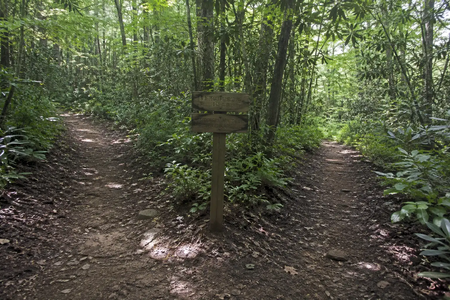
One more habit helps enormously: check your position at junctions, not just when you feel lost. Research on lost hiker behavior shows people go wrong at decision points, so a five-second glance at a trail split prevents an hour of backtracking. If it happens anyway, knowing what to do the moment you realize you are off route matters more than any device.
FAQs about Hiking GPS

Does GPS work without internet or cell service?
Is a GPS watch enough for hiking?
Does airplane mode stop GPS from working?
Which is better for hiking, a phone or a handheld GPS?
Do I need a satellite device if I always hike with a group?
Final thoughts
You almost certainly do not need to buy a dedicated GPS unit to start hiking. Set up your phone properly, download offline maps, carry a power bank, and add a paper map with a compass you know how to use. That combination handles the overwhelming majority of trails safely.
Upgrade when your trips outgrow it. Multi-day routes, off-trail travel, harsh weather, and long stretches without cell coverage all justify a rugged handheld or a satellite communicator. Buy the tool your hardest planned trip requires, then learn it thoroughly before that trip begins.