Velakhum Trek: Routes, Permits, and Costs
Velakhum is one of the most stunning spots in Bandarban, and reaching it takes a real trek. I have put together everything you need to plan the trip: routes, costs, permits, lodging, food, and what to pack. So let me walk you through it the way I would tell a friend.
Velakhum sits deep in Thanchi, Bandarban, near the Bangladesh–Myanmar border. To reach it, you first travel to Bandarban, then Thanchi, then ride a boat up the Sangu River to Remakri, and finally trek through Nafakhum and Thuisapara before crossing Debota Pahar. The full journey usually takes about three days each way, so plan for time and stamina.
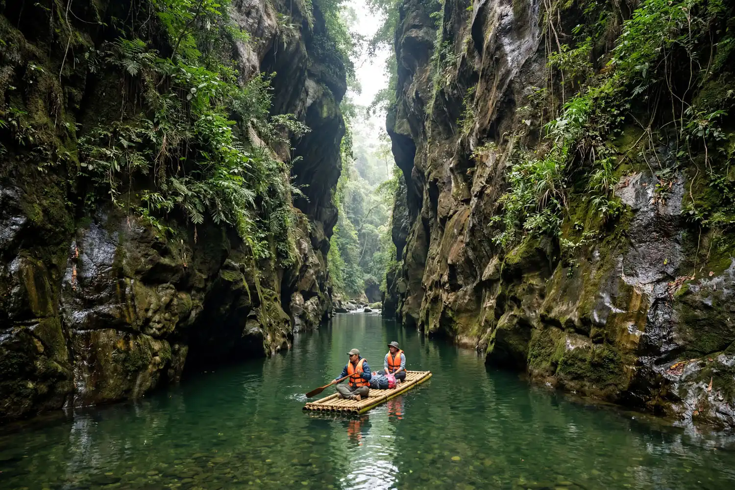
What makes Velakhum special is the scene itself. Tall stone walls rise on both sides, and a narrow, calm, clear green stream runs between them. You float through that channel on a bamboo raft while the rock canyon towers over you. Honestly, it feels like nature poured everything it had into one small place.
See similar stunning spots in Bandarban: Debotakhum
Where is Velakhum located?
Velakhum is located in Thanchi Upazila of Bandarban district, near the Bangladesh–Myanmar border, at a remote area called Nakshyong. It sits in the same cluster of waterfalls as Amiakhum and Satvaikhum, deep inside the hills past the last roadhead. Because the spot is so far from any town, you cannot drive there. Instead, you reach it through a mix of river travel and long trekking, which I will break down below.
When is the best time to visit Velakhum?
The best time to visit Velakhum is from September to November, right after the monsoon and just before winter. Velakhum holds water all year, and it simply changes character with the seasons. During the monsoon the flow is heavy and dramatic. In winter the water drops, yet it never fully dries up, so the canyon still looks beautiful.
I push people toward that post-monsoon window for practical reasons too. During peak monsoon, the Sangu River often rises near its danger level, so the administration may not grant permission to travel. Leeches also come out in larger numbers then. On top of that, the rock paths turn slippery and sudden rain can stall the whole group. Therefore the calmer shoulder months give you safer trails and steadier permits.
Know more places: Annapurna Base Camp Trek
How do you get to Velakhum?
To get to Velakhum, you first reach Bandarban district, then move on to Thanchi Upazila, and from Thanchi Bazar you pick one of two routes into the hills. Both routes end at the same place through Debota Pahar, but they differ a lot in difficulty.
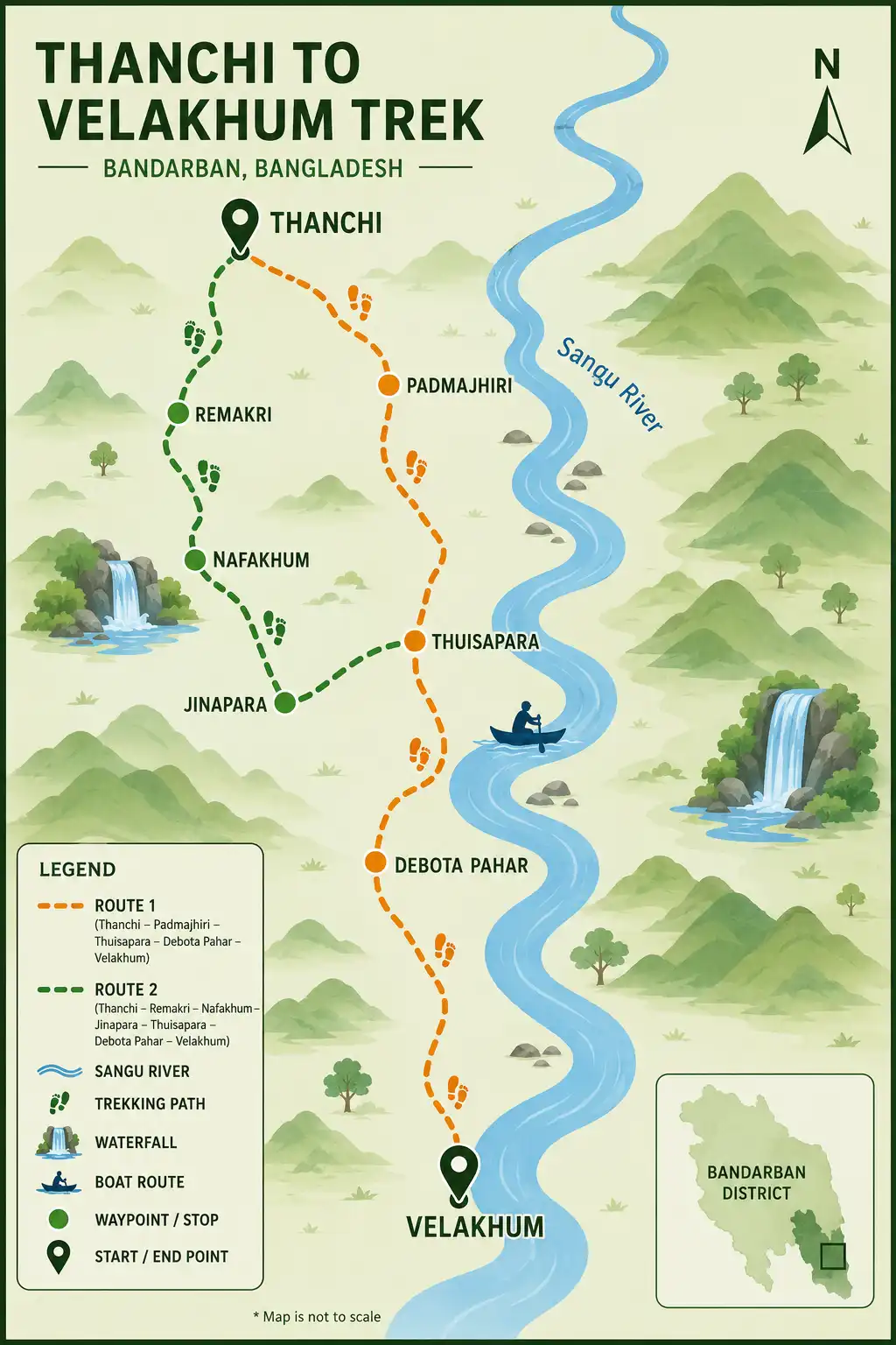
Route 1: Thanchi → Padmajhiri → Thuisapara → Debota Pahar → Velakhum
Route 2: Thanchi → Remakri → Nafakhum → Jinapara → Thuisapara → Debota Pahar → Velakhum
On the first route, just reaching Thuisapara takes about six to seven hours of trekking, and sometimes you end up walking after dark. The second route, by comparison, is easier and far less punishing. So many groups go in on one route and come back on the other. Personally, I like riding the boat to Remakri on the way in and saving the long overland walk for the return, when you already know the trail.
Also see my latest Kaptai Lake Travel Guide
Dhaka to Bandarban
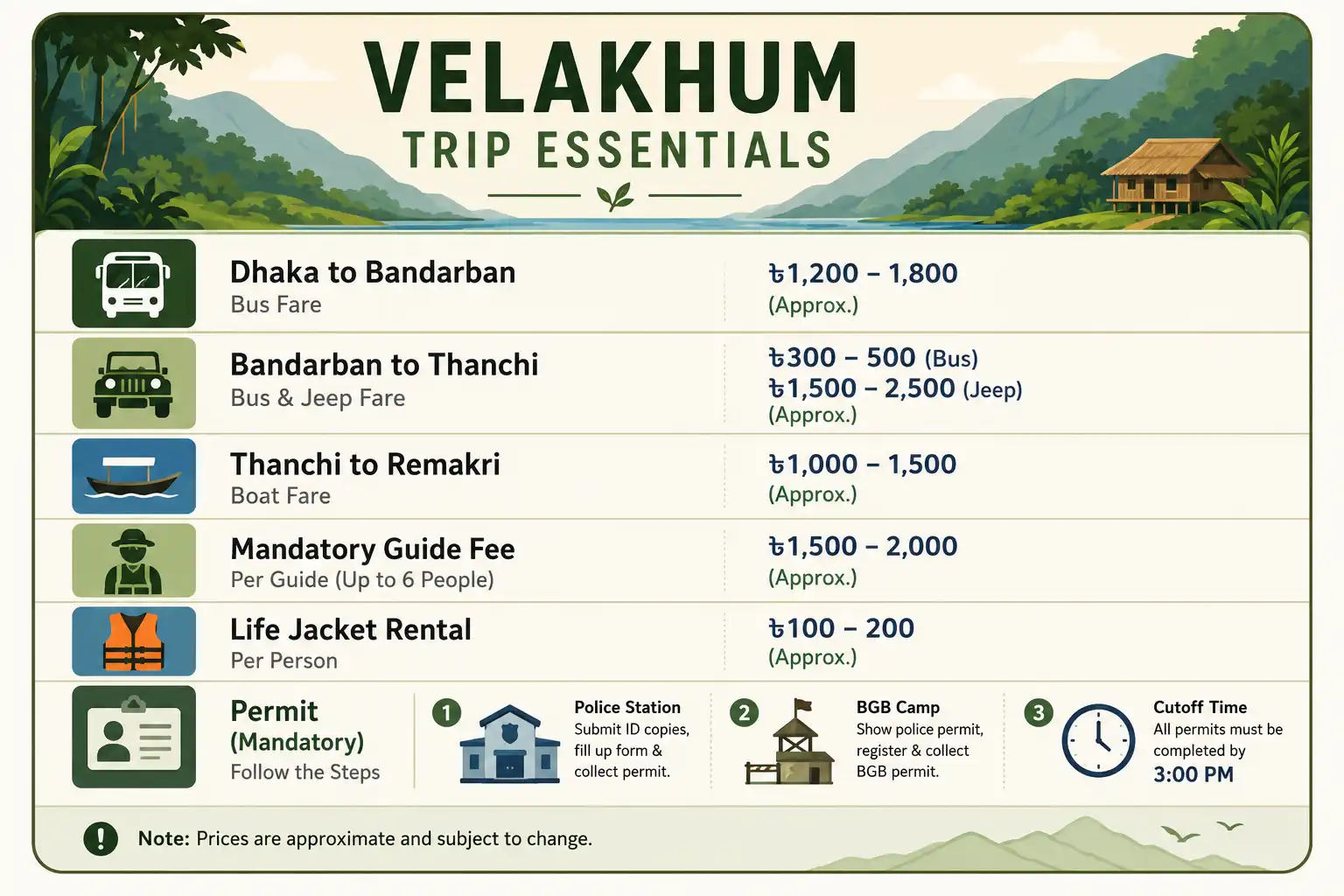
From Dhaka, you can catch a direct bus to Bandarban from Kalabagan or Arambagh. Companies like Shyamoli, Hanif, Saint Martin, and Desh run AC, non-AC, and Hyundai coaches to Bandarban every day and back. Non-AC fares run roughly 550 to 750 BDT per person, while AC fares sit around 1,200 to 1,500 BDT. If you take a night bus, you usually reach Bandarban by about 7 a.m., which sets you up for an early start.
You can also fly or take a train to Chittagong first, then continue to Bandarban by bus or private car. Buses leave from the Boddarhat and Dhampara stands for around 220 BDT, and a reserved microbus costs about 3,000 to 3,500 BDT. Prices shift over time, so treat these as ballpark figures and confirm before you book.
Bandarban to Thanchi
From Bandarban, you reach Thanchi by local bus or by reserved jeep, which locals call Chander Gari. Buses leave the Thanchi stand in Bandarban town about once an hour, cost roughly 200 BDT per person, and take four to five hours. A reserved jeep is fixed by the administration at about 6,000 BDT, though if you grab one a little before the main stand you might save 500 to 1,000 BDT.
For a bigger group, the jeep is the better call. It takes about three to three and a half hours and seats ten to twelve people. Along the way you pass Milanchari, Chimbuk Hill, and Nilgiri, plus a string of gorgeous hill landscapes where you can stop and take photos. That stretch of road alone is worth the seat by the window. If your team is large, splitting these reserved costs makes the whole trip far cheaper.
Thanchi to Remakri: permits, guides, and the boat ride
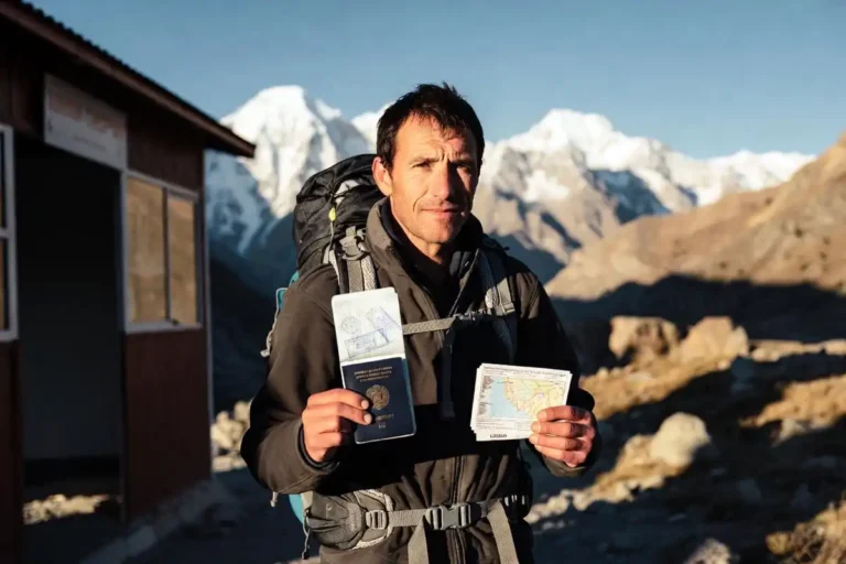
At Thanchi Bazar, you must hire a guide from the official list kept at the BGB camp, and this step is mandatory. The guide fee is about 1,500 BDT for going in one day and returning the next. After that, everyone in the group writes down their name, address, phone number, home contact, National ID copy, destination, and number of days, then collects permission from the police station (thana) and the BGB camp. The police also take a group photo for their records. Your guide helps you through every part of this paperwork, so it goes faster than it sounds.
One rule matters a lot here. No permission is granted after 3 p.m., so you must reach Thanchi before then. Otherwise you will lose the day and start out the next morning instead. Because of that cutoff, I always aim to be in Thanchi by early afternoon at the latest.
Life jackets rent for about 50 BDT each. During the monsoon, grab one for every person. Outside the monsoon, at least make sure every non-swimmer has one. Either way, do not skip them, since the river current can turn strong without warning.
Once your permission clears, you rent a small engine boat from Thanchi ghat. The fixed fare is about 4,500 BDT for the trip in and the return the next day, and each boat seats four to five people. The ride to Remakri takes around two and a half hours. When the water runs low, you may need to step out and walk past a few shallow stretches.
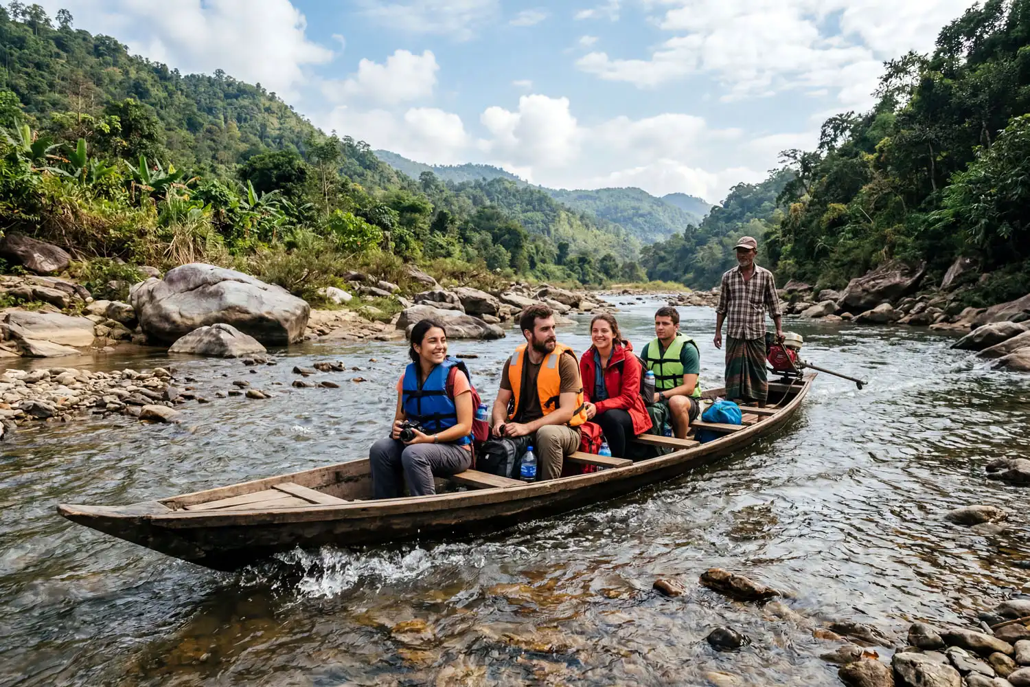
The Sangu River itself steals the show on this leg. You glide past Padmamukh, Tindu, Rajapathor, Boropathor, and finally Remakri. For safety reasons you cannot stop everywhere, but you can get off at the Boropathor area for photos. A dip at Remakri Falls is a real treat too, because the cold river water cools you right down after the heat of the boat.
Remakri to Thuisapara: the canal walk past Nafakhum
If you reach Remakri in the afternoon, stay the night there and set off for Nafakhum the next morning. From Remakri you hire one more local guide for about 500 BDT, which your Thanchi guide arranges for you. This local guide leads you to Nafakhum, and if you still have daylight, you can push straight on.
Walking along the Remakri canal to Nafakhum takes about two to two and a half hours, less if your group moves well. Along the way you cross the canal two or three times. The water sits knee-deep in some spots and waist-deep in others, yet the current stays strong, so footing matters. Apart from two or three rough patches, the rest of the trail is reasonably comfortable. If you want a sense of that stretch before you go, my full write-up on the trail up to Nafakhum waterfall covers the river crossings in more detail.
After you soak in Nafakhum and take your photos, you head for Thuisapara. From Nafakhum it is another three to four hours of trekking to reach the village. Should it run late, you can break the day and sleep at Jinapara, the village just before it. I usually treat that first long trekking day as the real test, so I keep the pace honest and steady rather than racing.
Thuisapara to Velakhum: over Debota Pahar
From Thuisapara, you sleep the night, then leave the next morning with another guide (about 500 BDT) and head toward Velakhum by way of Debota Pahar. There are two paths out of Thuisapara. One mixes a stream (jhiri) trail with a hill trail, and the other is purely a hill trail. A smart approach is to take the hill path going in and the stream path coming back.
On the hill-only path, thirty minutes of trekking brings you to the first hilltop. Rest for a bit, then push on. Another thirty minutes lands you at the second hill, known as Nicolas Pahar. You actually get mobile network here, and a few families live in the small settlement called Nicolas Para. Take a short break, then start trekking again toward the high ground ahead.
Soon you reach the summit of Debota Pahar, and this is where the trip gets serious. Climbing down from Debota Pahar is difficult and genuinely dangerous, so stay careful. In places the descent drops at an 80 to 90 degree pitch, and getting to the bottom can take roughly an hour. At the base, the right-hand trail leads to Velakhum and Naikkhongmukh, while the left-hand trail heads toward Amiakhum and Satvaikhum.
Because that descent is so steep, this is exactly the kind of trail where I bring trekking poles to save my knees, and where good footing makes all the difference. Once you are down from Debota Pahar, a five-minute walk drops you right at Velakhum. From Thuisapara the whole stretch takes about three hours, give or take, depending on your team’s stamina.
What Velakhum looks like up close
At Velakhum, a calm, clear green stream flows through a corridor of tall stone walls, and you explore it on a bamboo raft. That raft is the only way to move through this section, so you drift slowly and let the canyon do the talking. The water you see here actually flows down from Amiakhum above, which keeps the channel alive even in the drier months.
A little farther along, you step off the raft and pick your way through gaps in the rock to reach another small waterfall called Naikkhongmukh. Right beside Velakhum sit Amiakhum and Satvaikhum, so build your travel plan to take all three in one push if your time and energy allow. On the return, spend a night again at Thuisapara, walk back to Thanchi by the same or a different route, and then ride from Thanchi to Bandarban before heading home.
Where to stay near Velakhum
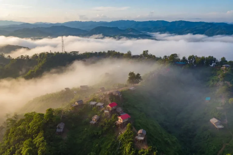
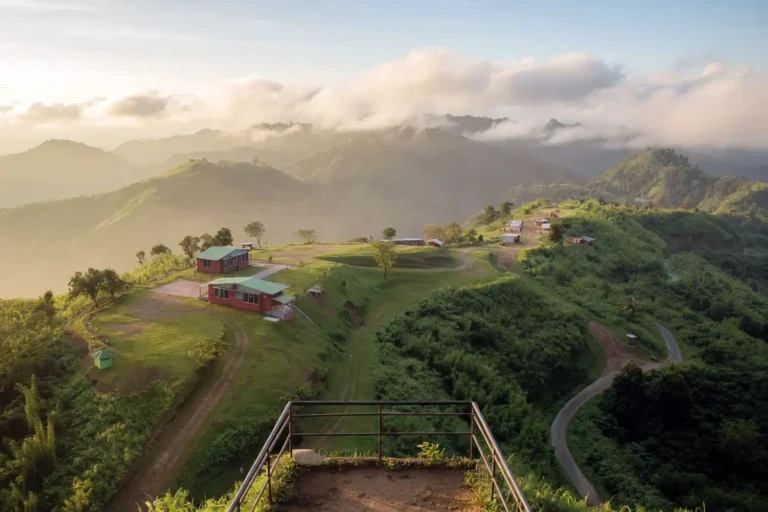
After Thanchi and Remakri, there are no formal hotels, so indigenous village homes are your only and best option. These homes welcome travelers and keep solid arrangements for sleeping, and your guide sorts out the bookings for you. Across this long route you pass Remakri, Nafakhum Para, Jinapara, and Thuisapara, and most groups spend their nights in these villages. They are safe, simple, and warm, and staying in them is part of what makes the trip memorable.
Where to eat on the trek
After Thanchi, you eat in the indigenous homes along the route, and the food is better than first-timers expect. A typical plate includes rice, vegetables, dal, mashed potato (alu bhorta), and chicken. Tell your guide ahead of time what you want, and he arranges it before you arrive. Still, carry some light, dry snacks of your own, such as dates, biscuits, chocolate, chira, muri, and fruit.
You will also find small grocery shops in several villages selling soft drinks, biscuits, and mineral water, plus seasonal hill fruit worth trying. Since the entire route demands hard trekking, your body needs steady fuel, so eat a little and often rather than skipping meals. If you treat stream water as drinkable without thinking, learn making stream water safer to drink first, because clean water keeps the whole group moving.
Travel tips and safety for Velakhum
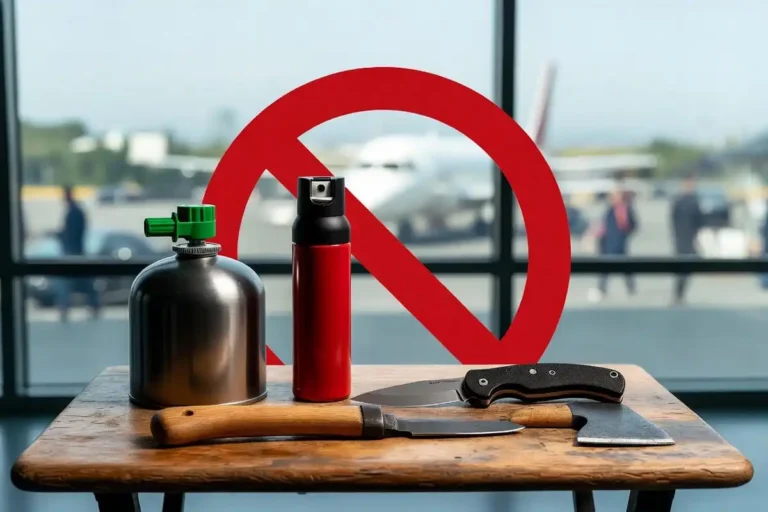
A few habits make this trek smoother and far safer. To cut costs, avoid public holidays and travel as a group so you can split the jeep and boat fares. For the trail, wear shoes with strong grip, since the rocky paths get slippery fast. Carry a life jacket if you cannot swim or if you go during the monsoon, and walk those wet rocks slowly and deliberately.
After Thanchi there is no electricity and no mobile network, so charge your phone and power bank fully before you leave town. Keep only a shoulder bag and trim its weight as much as you can. Pack the basics you might need, including paracetamol, antacids, and oral saline, and tuck them somewhere easy to reach.
A long, remote route like this also rewards a bit of training. Before you go, it helps to know the fitness level a multi-day trek really needs, and to break in your footwear early so blisters do not end your trip. Good trail socks that prevent blisters are worth packing too, especially over three full days of walking. Most of all, never wander off alone, keep an eye on your teammates, step in when someone struggles, and treat the indigenous communities with respect. If you enjoy this kind of remote hill adventure, the Keokradong peak trek nearby makes a natural next goal.
Final thoughts
Velakhum is not an easy trip, and that is exactly why it stays with you. You earn every meter of that stone canyon through river rides, water crossings, and a steep climb over Debota Pahar. Go in the post-monsoon window, hire your guides, sort your permits before 3 p.m., pack light, and move as a careful group. Do those things, and you will float through one of the most beautiful corners of Bandarban with a story worth telling for years.