What to Do in Tahiti Hikes and Waterfalls: Permits, Costs and Best Months

Tahiti has a steep, green interior that most visitors skip. This guide covers the island’s best hikes and waterfalls, what each one costs, which permits you actually need, and the access changes that happened in 2026.
What are the best hikes and waterfalls in Tahiti?
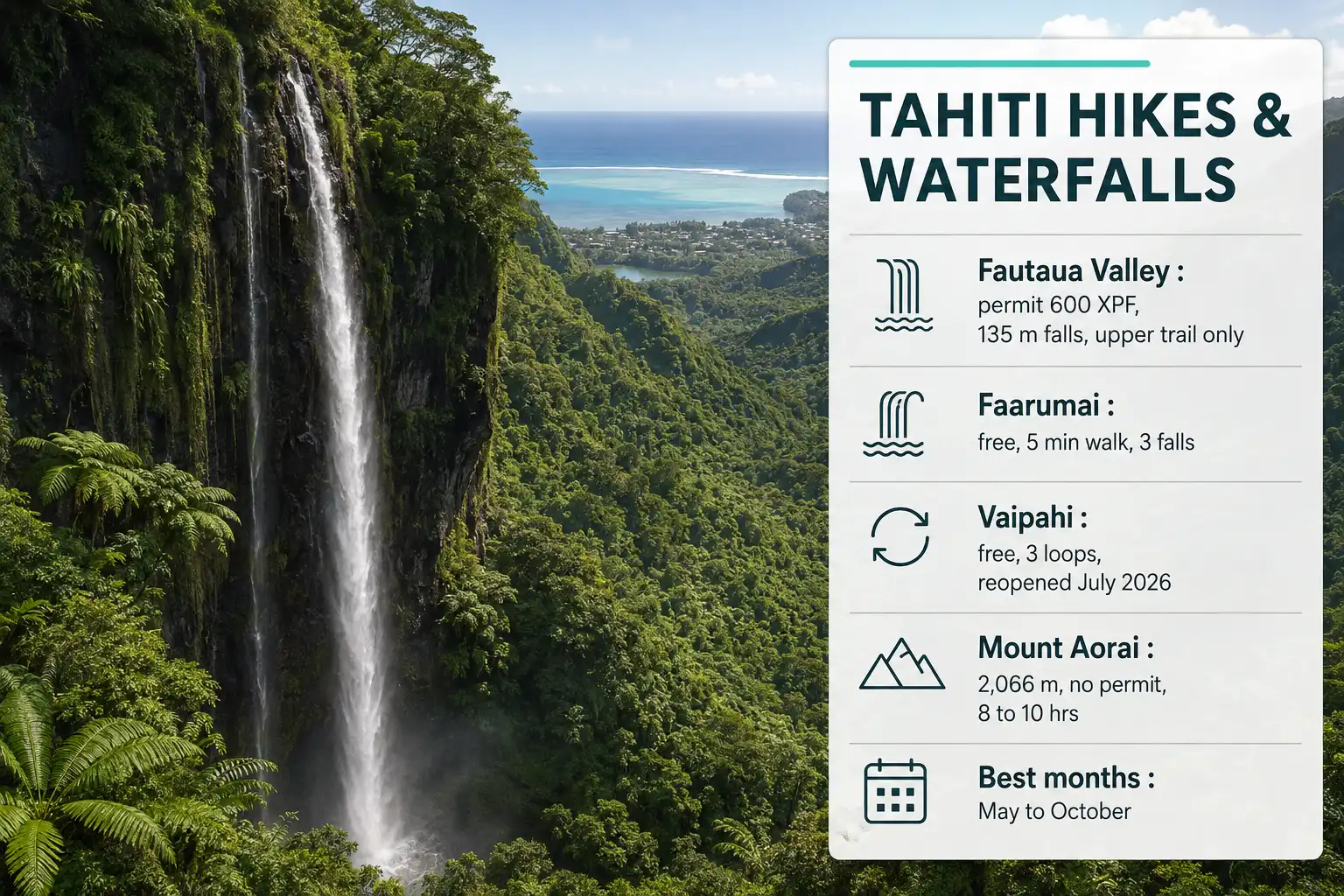
The three easiest wins are Fautaua Valley near Papeete, the Faarumai Waterfalls at Tiarei, and the Vaipahi Water Gardens on the south coast. Mount Aorai is the big mountain day. Papenoo Valley and the Hitiaa lava tubes both work better with a guide than alone.
Two of these changed recently, so old blog posts will steer you wrong. The Vaipahi trails reopened on July 1, 2026 after roughly seven months of safety work. Fautaua Valley reopened on July 6, 2026 after a much longer closure, and it came back with stricter rules.
I have not hiked Tahiti myself, so treat this as a research guide rather than a trip report. Access details below come from the Papeete town hall, the French Polynesia tourism service, and local operators, all checked in August 2026. Where my own trekking experience genuinely transfers, mostly around wet rock and mosquitoes, I say so.
Also know: Hike the Grand Canyon
Fautaua Valley: Tahiti’s tallest accessible waterfall
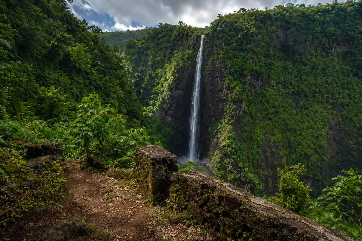
The valley sits about 15 minutes from downtown Papeete, and the waterfall drops 135 meters into a basalt gorge. Papeete’s town hall lists the walk in as roughly two hours over ground that gets steep in places but stays manageable for most reasonably fit walkers.
Pierre Loti wrote about this valley in the 1870s, which is why locals also call the falls Cascade de Loti or Cascade de Fachoda. You will pass a restored marae about 30 minutes in, plus the ruins of Fort Fachoda higher up.
The commune closed the lower trail that runs to the base of the falls, and it stays closed until further notice. Only the upper section is open right now. Swimming in the pools is also off the table, because rockfall across the site caused injuries in the past.
So set expectations before you go. You still get the valley, the marae, the gorge, and a view of the falls from above. What you miss is the swim that older posts keep promising.
How do you get the Fautaua permit?
Pay at the town hall régie before you drive out, because a guard checks papers at the valley gate. As of August 2026 the office sits on the second floor of Building B at the Papeete mairie, open Monday to Thursday from 8am to 2pm and Friday from 8am to 1pm.
Rates run 600 XPF per adult and 150 XPF for children over 12, while under-12s go free. Cash, check, and card all work. Your form stays valid for one entry within three months, which helps if the weather turns.
The valley itself opens daily from 6am to 5pm. However, the last entry is 4:45pm, and everyone must be back at the parking lot by 5:45pm. Weekends cost the same as weekdays now, so that old “free midweek” advice is dead.
Since these details shift, call 40 41 57 00 or check papeete.pf the week you travel.
Faarumai Waterfalls: the easy three
The Faarumai site at Tiarei gives you three waterfalls for almost no effort, and it costs nothing. Parking is free too. From Papeete you drive about 28 km east along the coast road, roughly 30 to 45 minutes depending on traffic, then turn inland at the sign for the Trois Cascades.
Vaimahuta comes first, an 80-meter drop reached by a paved five-minute walk. Families with strollers manage it fine. Behind it, Haamaremare Rahi falls 100 meters and Haamaremare Iti falls 40 meters, both about 20 to 30 minutes further along a rougher, muddier path.
That upper gate closes during bad weather, so a wet morning may leave you with only the first fall. Swimming stopped years ago after falling rock struck a visitor, and the ban still holds.
Mosquitoes here are genuinely aggressive. I deal with the same problem on waterfall treks in the Bandarban hills back home, and the habits I use for handling mosquitoes on humid trails carry over to the Pacific without much change.
Vaipahi Water Gardens: gardens plus three real trails
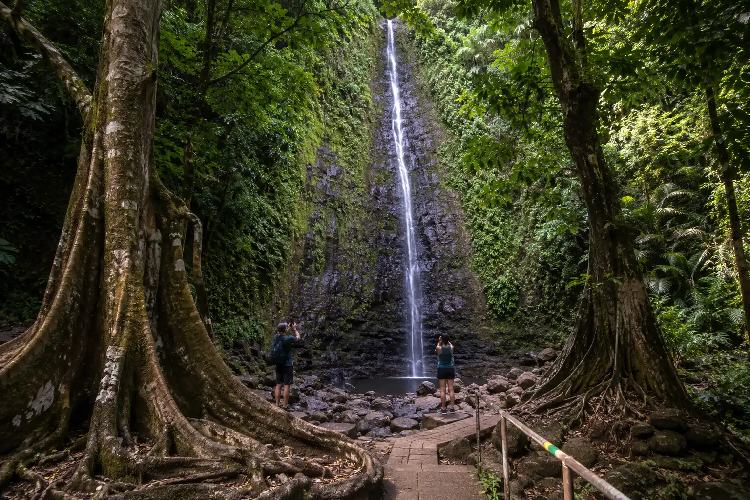
Vaipahi sits at PK 49 near Mataiea on the south coast, about an hour from Papeete, and entry is free. The lower botanical garden holds more than 75 plant species around ponds and a small waterfall, and it stays flat enough for almost anyone.
Above the garden, three marked trails climb the hillside: a river trail of about 1 km, a small loop of about 2.7 km, and a great loop of about 5.1 km. The great loop opens up wide views over the lagoon and the peninsula. Ropes secure the steeper and wetter sections.
These trails were closed from December 10, 2025 while crews rebuilt them, then reopened on July 1, 2026. Officials warned that the site may still close during weather alerts, so check before making the drive. The tourism service number is 40 47 62 00.
Leave the flip-flops at the hotel. That river trail crosses water on slick rock, and hikers who tried it in sandals turned back.
Mount Aorai: the serious climb
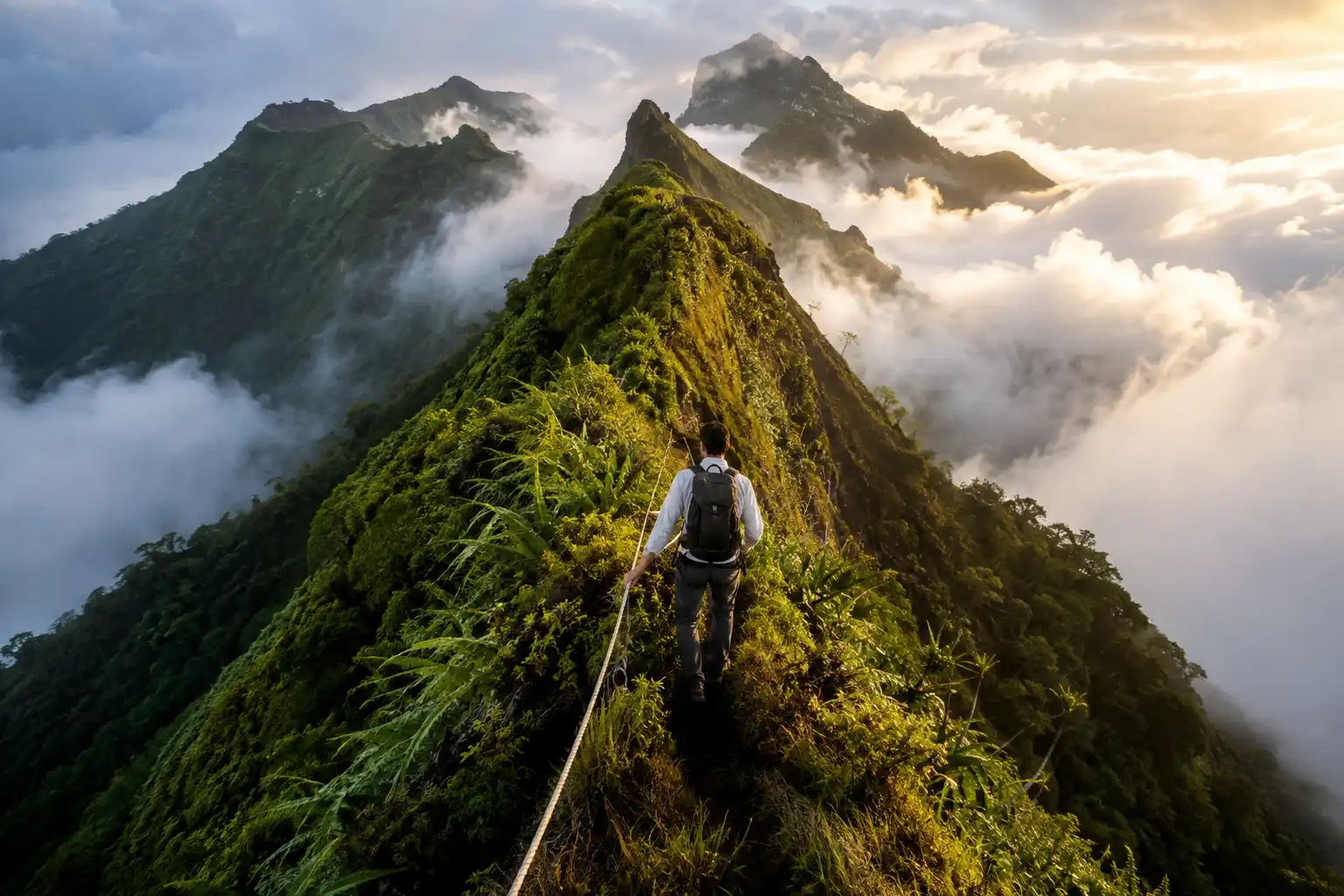
Aorai is Tahiti’s third-highest peak at 2,066 meters, and the trail starts at the O Belvédère restaurant above Pirae at around 600 meters. The full round trip runs roughly 18 to 20 km with about 1,500 meters of climbing. Most people need eight to ten hours, and plenty split it across two days.
Two free huts break up the route. Fare Mato sits at 1,400 meters, a little over two hours in, and Fare Ata sits at about 1,800 meters. Both have mattresses and rainwater tanks but no power and no staff, so bring food, a stove, and a sleeping bag. Rainwater from a tank still needs treatment, and the same rules for making backcountry water safe to drink apply here.
Past Fare Mato the trail turns technical. Narrow ridges, fixed ropes, and long drops define that stretch, and mud makes everything worse. Turning around at the first hut is a perfectly good day out, and many fit hikers do exactly that.
For context, 1,500 meters of climbing in one push sits well beyond an average day hike. Start before dawn if you want the summit clear of cloud.
Papenoo Valley: waterfalls by 4×4
Papenoo is Tahiti’s largest valley, and a rough track runs up it to the island’s old volcanic caldera. Three named waterfalls line the route: Topatari at about 80 meters, Vaiharuru at roughly 50 meters, and Puraha near the hydro dam. After heavy rain, dozens more appear on the valley walls.
You need a four-wheel drive, and the track crosses the river several times. Because washouts happen and directions get confusing, most visitors book a guided safari instead. Half-day trips run about four to five hours, while full-day versions cross the tunnel to Lake Vaihiria and drop out on the west coast.
Operators cancel after heavy rain, so build a spare day into your plan if this matters to you.
Hitiaa lava tubes: the underground option
The Hitiaa tubes are lava tunnels on the east coast that you walk through in the dark, in water, with a headlamp. Guides supply lamps and neoprene tops, and trips generally suit ages 12 and up.
Do not attempt these alone. Water levels inside change fast, and guides turn groups back when flow gets strong. Local operators run both a walking version and a technical canyoning version, with prices starting around 6,900 XPF.
Expect scrambling, wading, and cold pools. Also expect a long approach on a 4×4 track before the first tube.

Te Pari: the wild coast of Tahiti Iti
Te Pari runs along the uninhabited southern coast of the peninsula, and boats from Teahupoo drop hikers at the start. Cliffs, sea caves, coral flats, and a hut make up the route, and reaching the hut takes about three hours.
Swell can flood parts of the trail, therefore good weather is not optional here. Guides handle the boat logistics and know the tide windows, which is why almost nobody does this independently.
When is the best time for Tahiti hikes and waterfalls?
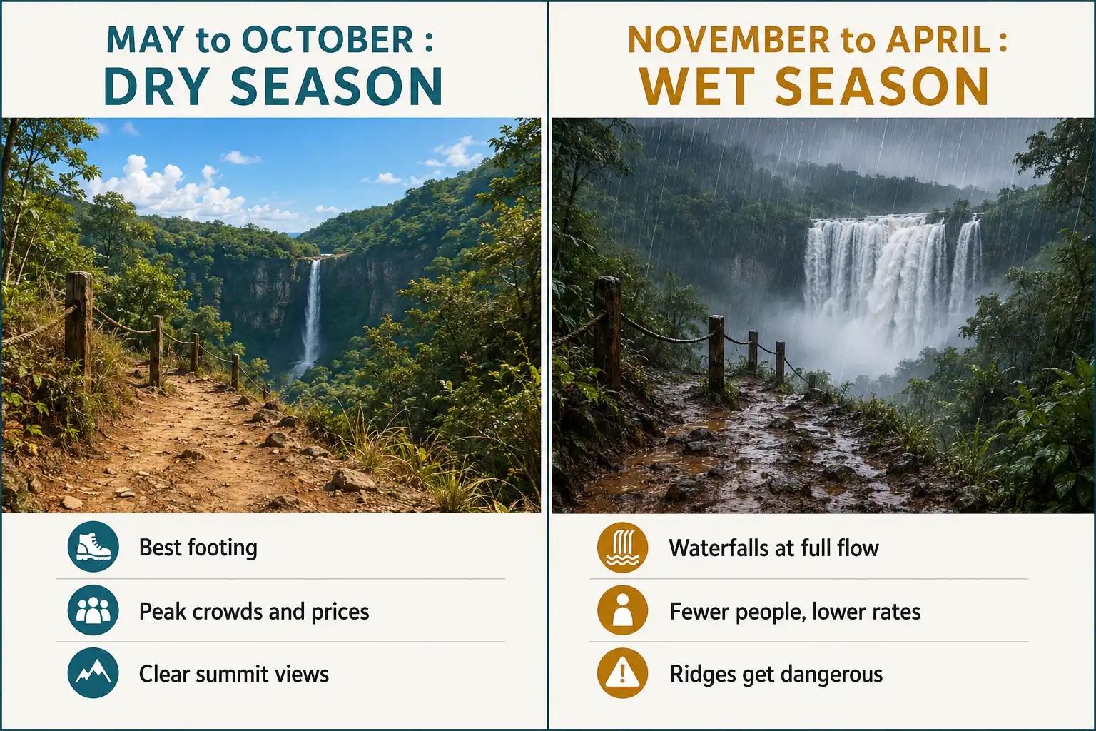
May through October is the dry season, and that window gives you the most reliable trail conditions. July and August bring the coolest, driest weather along with the biggest crowds and highest prices.
November through April flips it. Rain arrives in short heavy bursts, humidity climbs, and the waterfalls run at full strength. That trade-off is real: better falls, worse footing. Mountain routes like Aorai get genuinely dangerous when the ridges turn to mud.
April, May, September, and October land in the middle. Fewer people, decent weather, and lower rates make these months the sweet spot for hikers, and the same logic I use when picking a season for a destination trip applies cleanly to Tahiti.
One more thing. The east coast catches more rain than the sheltered west side, so Papeete and the south coast often stay drier than Tiarei on the same day.
Do you need a guide in Tahiti?
For Faarumai, Vaipahi, and the lower part of Fautaua, no. Those routes are marked and short. For the lava tubes, Te Pari, and Papenoo, yes, because the terrain, water, and access all demand local knowledge.
Aorai falls in between. The trail is well marked and needs no permit, though the exposed sections past Fare Mato justify a guide if you are unsure of your footing or heading up alone.
Tahitian guide fees vary widely. Budget roughly 7,000 to 15,000 XPF per person for a day trip, and confirm what the price includes before booking.
What should you pack for hiking in Tahiti?
Closed shoes with real grip come first. Wet basalt behaves like ice, which is the one lesson from waterfall trekking in Rangamati that transfers straight to Tahiti.
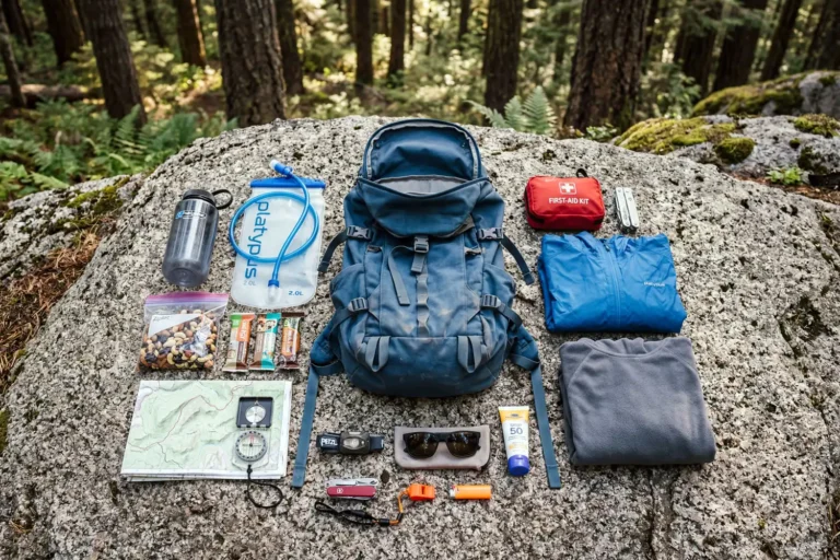
Beyond footwear, keep it simple:
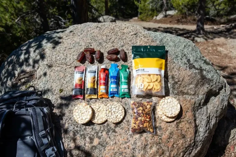
- Two to three liters of water per person, more for Aorai
- Strong insect repellent
- A light rain layer that breathes
- Quick-dry clothes and a swimsuit for the sites that allow swimming
- Headlamp for early starts and any cave trip
- Cash in XPF for permits and small stalls
Long pants beat shorts on the overgrown routes, since ferns and thorny brush cut up bare legs. A standard day hike packing list covers most of it, with repellent and grip bumped up the priority order.
Humidity here is heavy. Learning to move through tropical rain without overheating matters more than owning an expensive shell.
A simple three-day plan
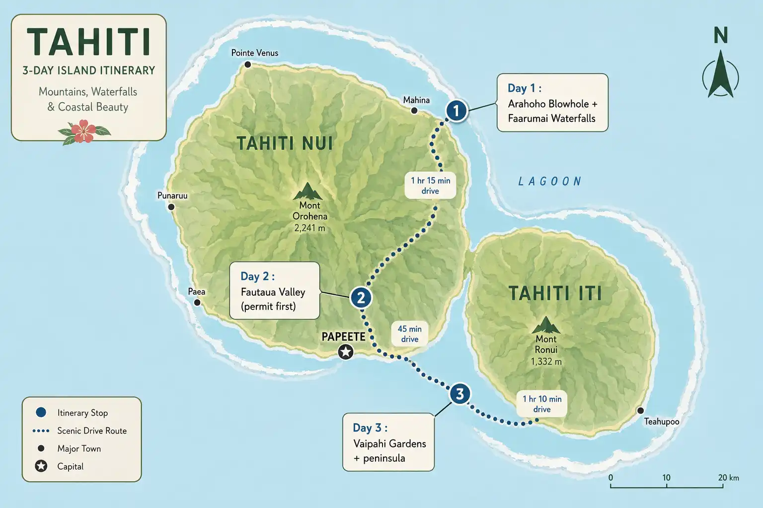
Day one, drive the east coast. Stop at the Arahoho blowhole, walk to Faarumai, and finish with a swim on the coast. That fills a half day comfortably.
Day two, sort your Fautaua permit in the morning, then hike the valley. Afternoon light in the gorge is good, but remember the 4:45pm entry cutoff.
Day three, head south to Vaipahi. Walk the great loop, then continue toward Teahupoo and the peninsula if time allows.
Add a fourth day for Papenoo by 4×4, or two days for Aorai with a hut night.
FAQs about Tahiti Hikes and Waterfalls

Can you swim in Tahiti's waterfalls?
How tall is the Fautaua waterfall?
Is Tahiti expensive for hiking?
Can you hike Tahiti without a car?
Do you need permits for Mount Aorai?
Final thoughts
Tahiti rewards anyone willing to leave the lagoon for a morning. Start with Faarumai if you have kids or limited time, add Vaipahi for a proper walk with a view, and save Fautaua for a day when the town hall is open. Aorai deserves respect and a dry forecast.
Access rules here change more often than most destinations, so confirm permits and closures the week you travel rather than trusting a post from two years ago. That single habit will save your trip.